What is OCTAS Modeler?
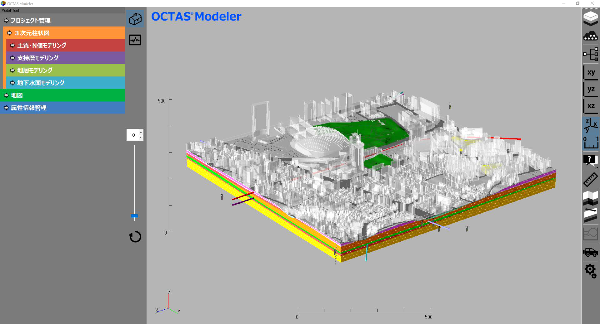
OCTAS Modeler is a system to support the utilization of subsurface information. It helps to grasp the positional relationship of the borehole logs and create various 3D models including borehole, soil, bearing layer, and terrain.
Features
1. Create 3D Model of Borehole Log
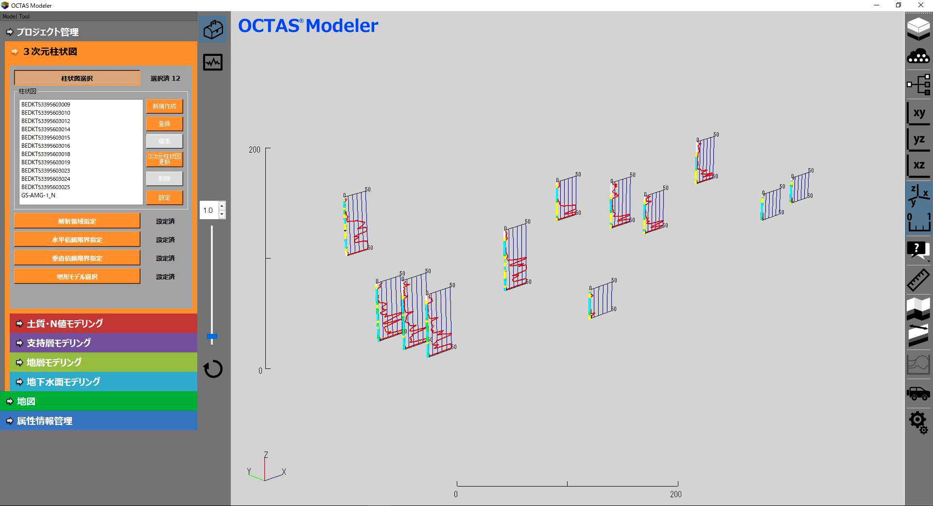
- OCTAS Modeler can create the 3D model of borehole log by using borehole logs that are formatted to Electronic Delivery Standard by Ministry of Land, Infrastructure, Transport and Tourism.*1 The model follows the guideline of CIM.*2
- The 3D borehole log can be exported, and be available to CAD.
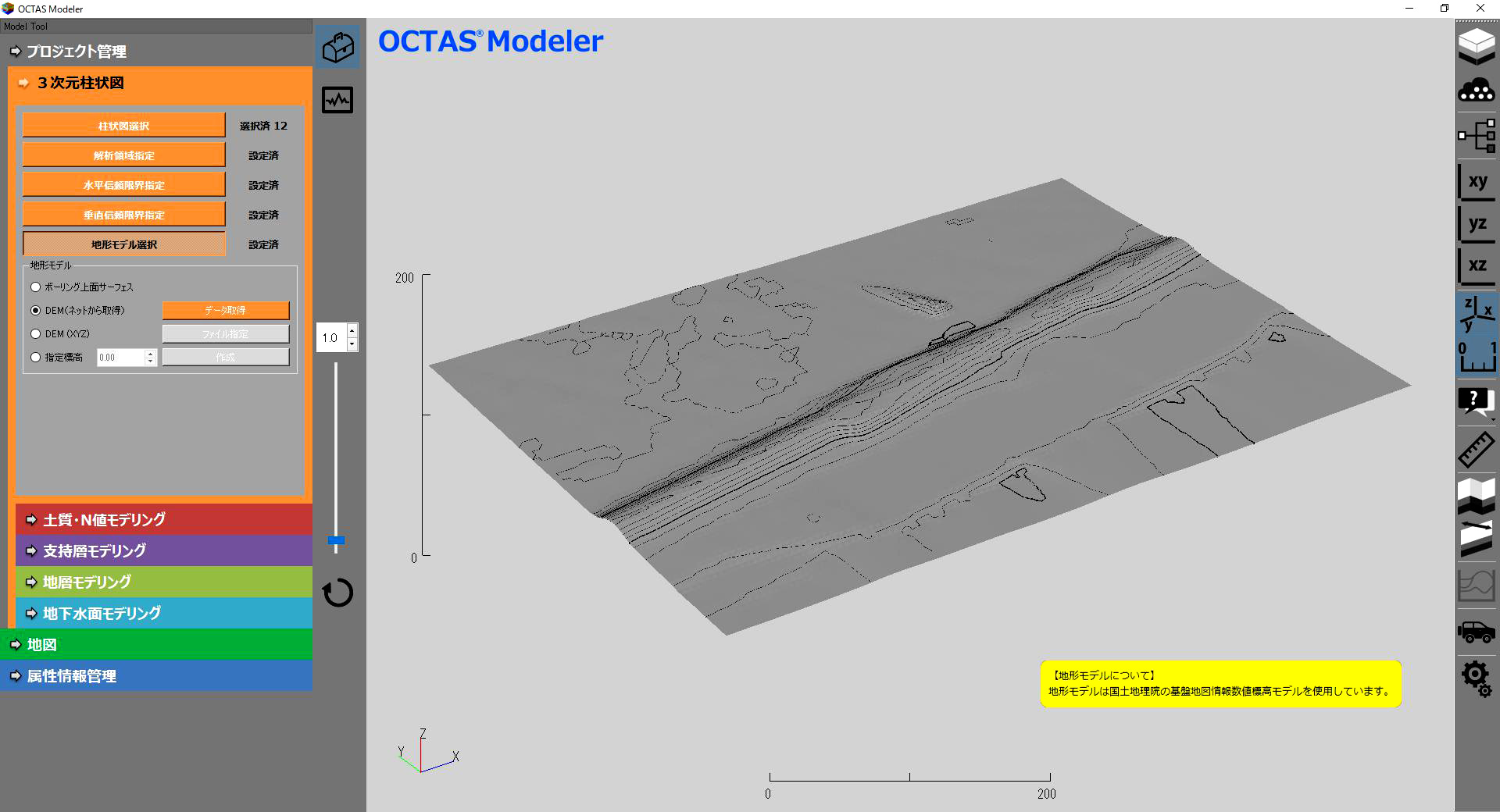
2. Create Terrain Model
- You can access to GSI*1 or NASA SRTM*2 to get DEM data.
- You can import your terrain data.
- Construct terrain model from DEM data.
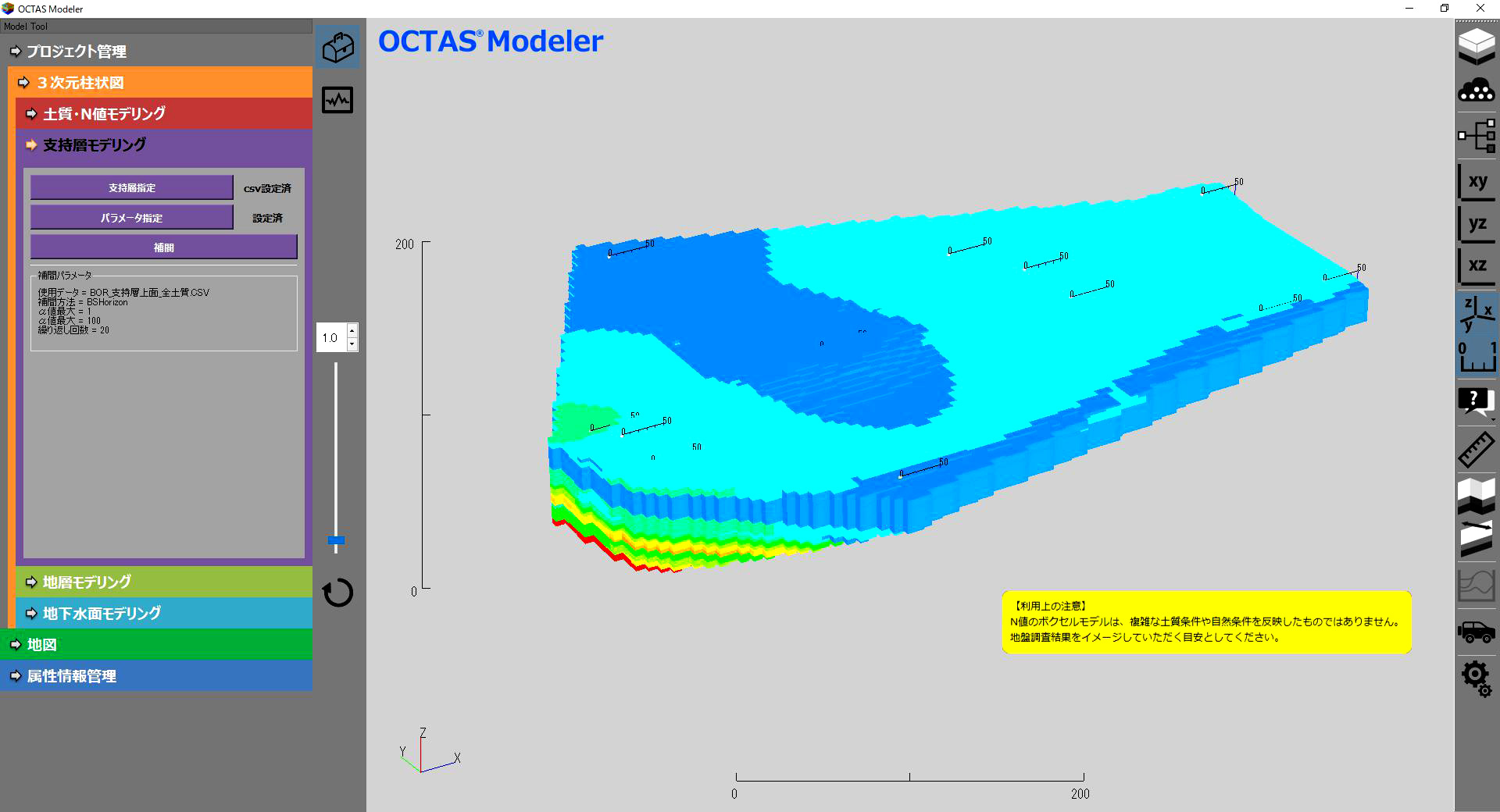
3. Create Subsurface Model
Following subsurface models can be created from borehole data:
- Geological formation model
- Soil and N-value model
- Bearing layer model
- Water table model
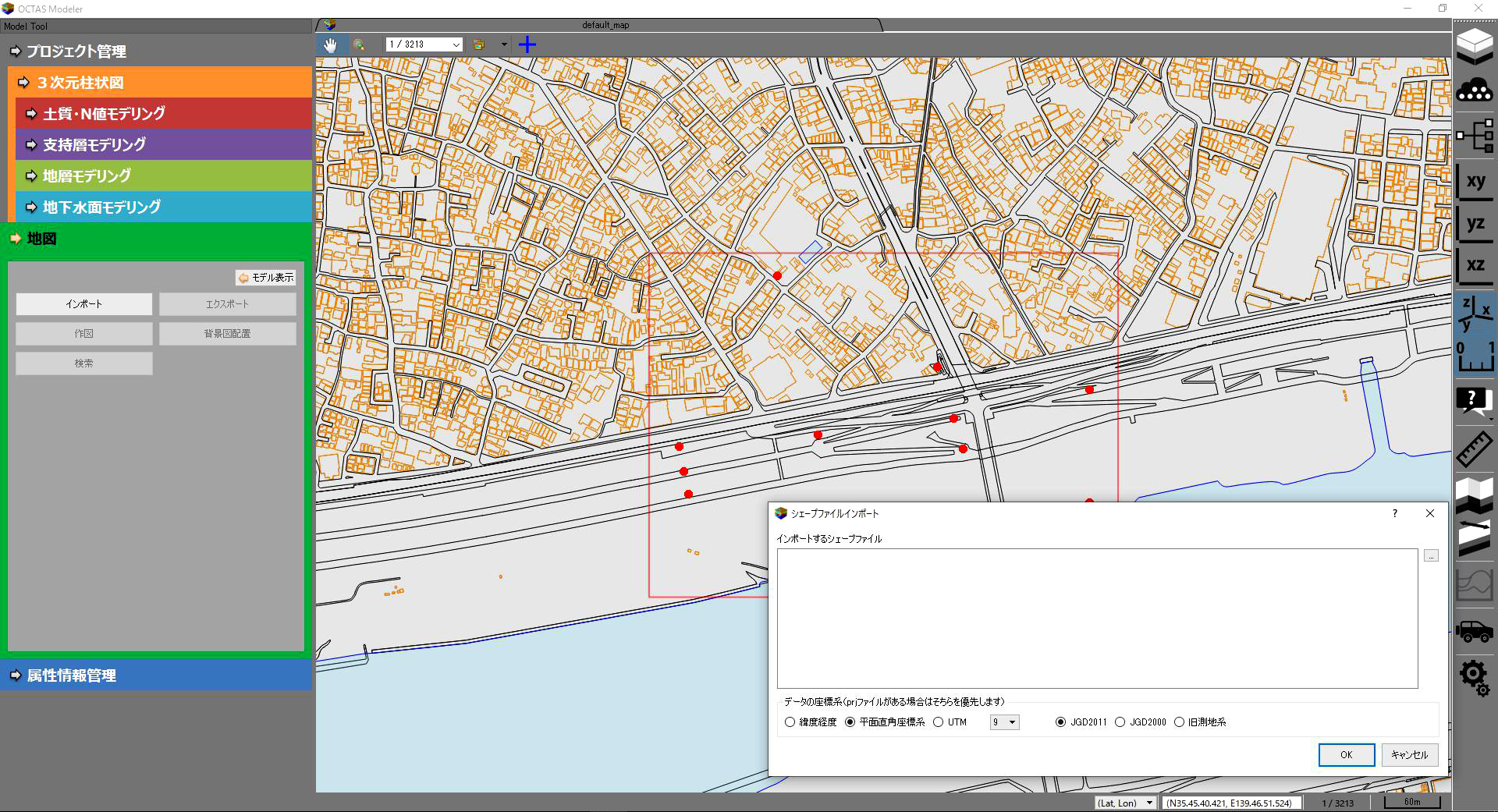
4. Display GIS Information
- You can import and display your GIS information.
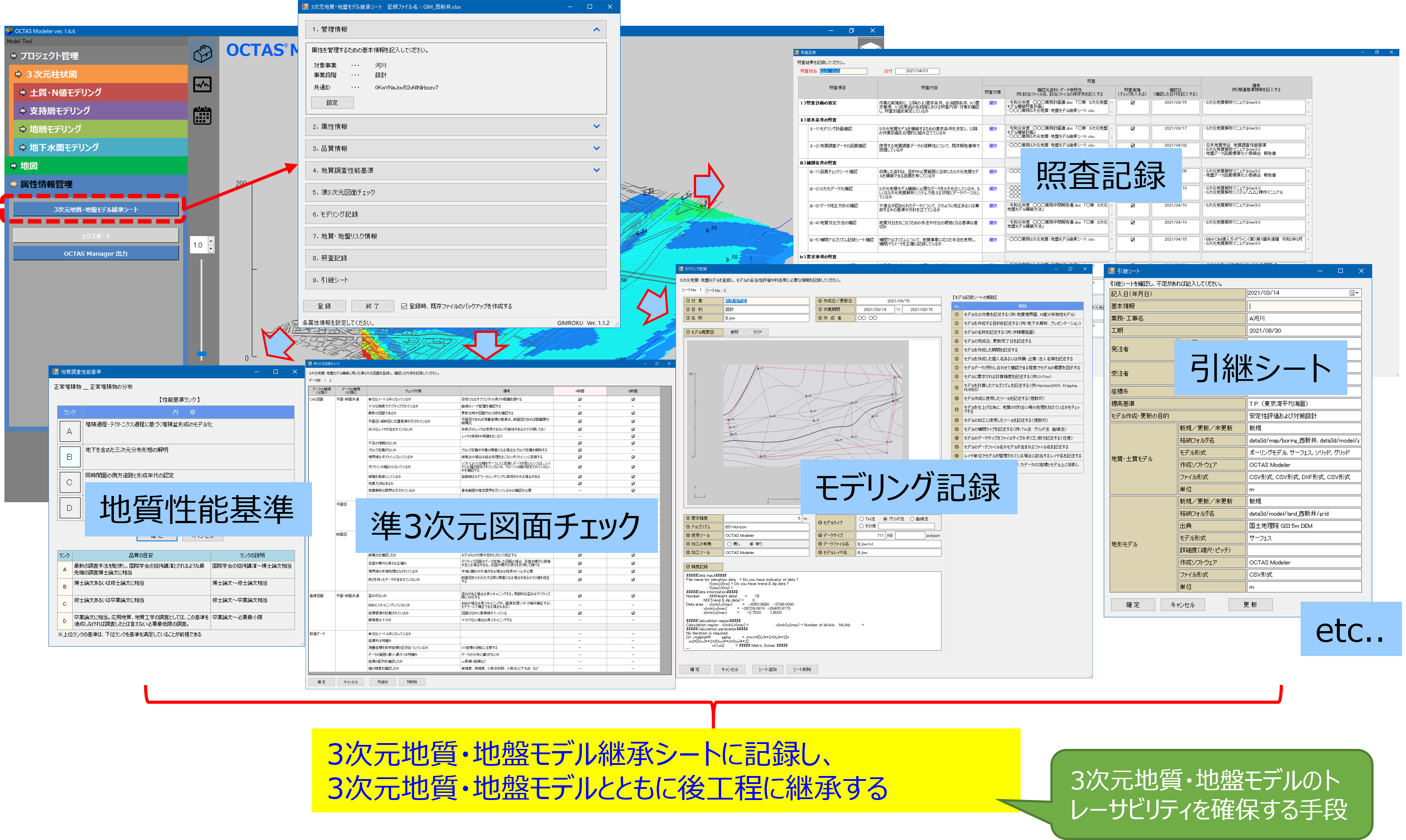
5. Create File Attributed to BIM and CIM
- Record attributed information of 3D geotechnical and geological formation models.
- Can export BIM and CIM attributed information as a file.
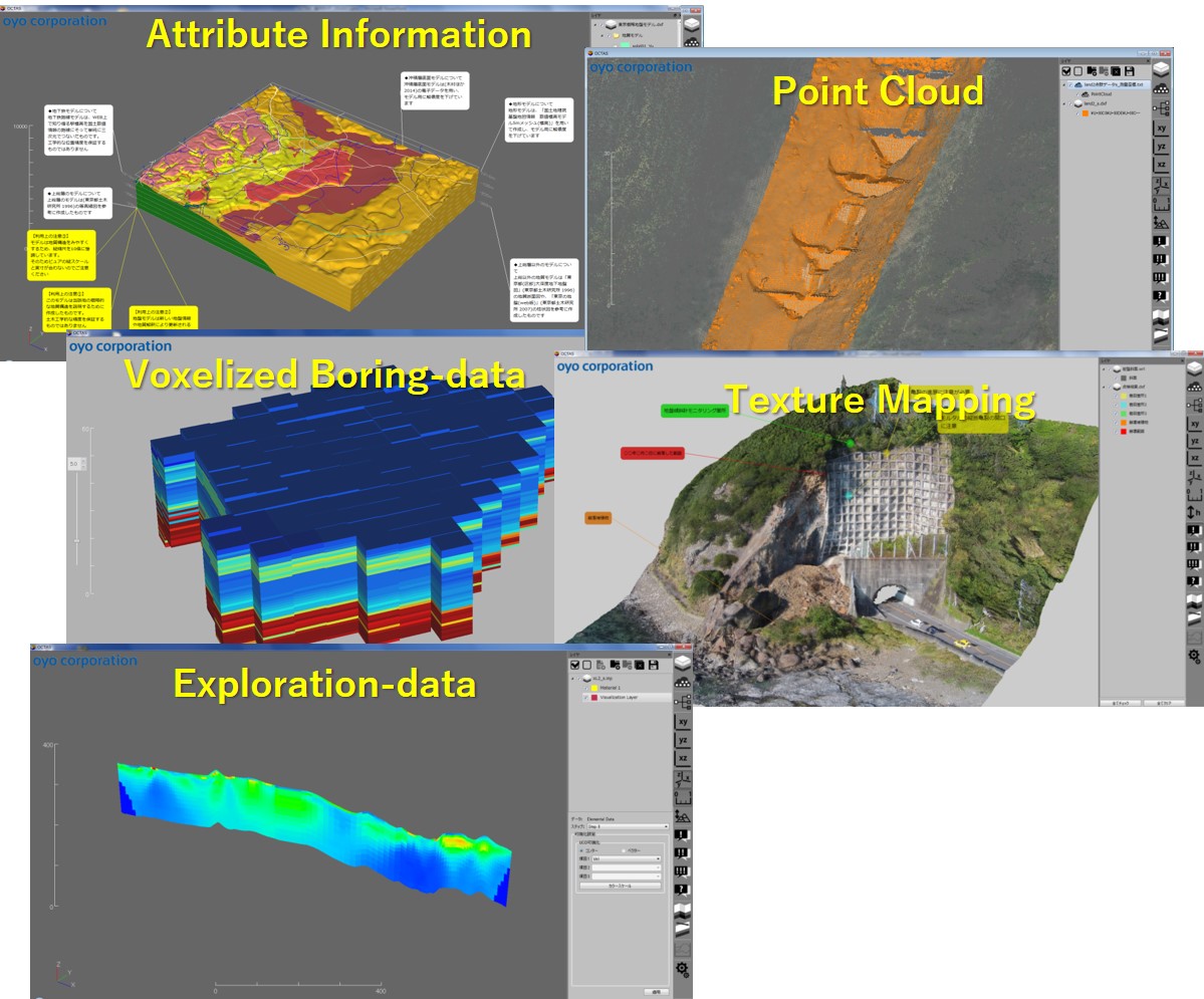
6. 3D Visualization Features
- Display 3D CAD (dxf) data.
- Display point cloud data.
- Clipping (Plane/Custom).
- Create geotechnical cross-section.
- Export geotechnical cross-section (dxf) data, etc.
Flow
You can purchase online. Please click "Purchase" button below and follow directions.
If you pay with credit card, it will redirect you to download link automatically. Credit card payment is the fastest way to get OCTAS Modeler.
System Requirements
| OS | Microsoft Windows 7/8.1/10 64bit It does not work with 32 bit. |
|---|---|
| CPU | Intel Corei3~i7 or compable GPU |
| RAM | 8GB or more |
| GPU | - |
| Monitors | 1920 x 1080 (Full HD) or more |
| HDD/SSD Free spaces needed | For install: - For work: - |