What is OCTAS?
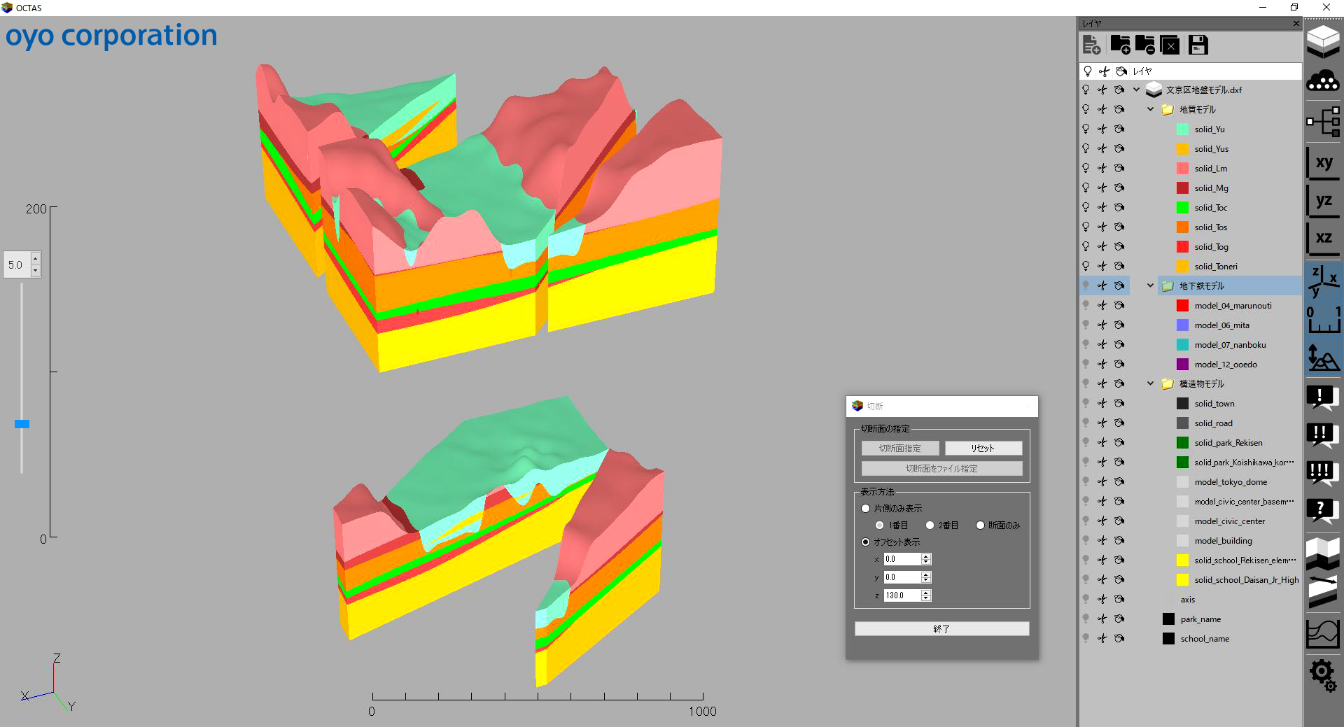
OCTAS visualizes 3D subsurface geologic model with simple and easy steps. It is possible to import models from other software, such as GEO-CRE. Moreover, it allows overlaying various ground information over the models, including specific geotechnical information and terrain data from a drone. OCTAS can create geotechnical cross-section at a free position and export it to CAD. To improve the quality of the model, various optional functions, such as visualization of measurement and physical data, are under development.
Features
1. Supported Data
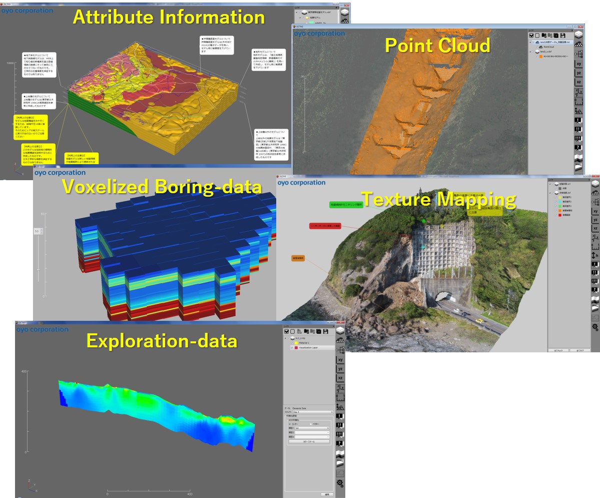
- 3D CAD (dxf Ver2004)
- VRML (VRML 2.0)
- Point Cloud (.txt)
- Compressed file (custom format: compressed and encrypted)
- attribute information (.txt) etc.
2. Display
- Clipping (Plane/Custom)
- Vertical Scaling etc.
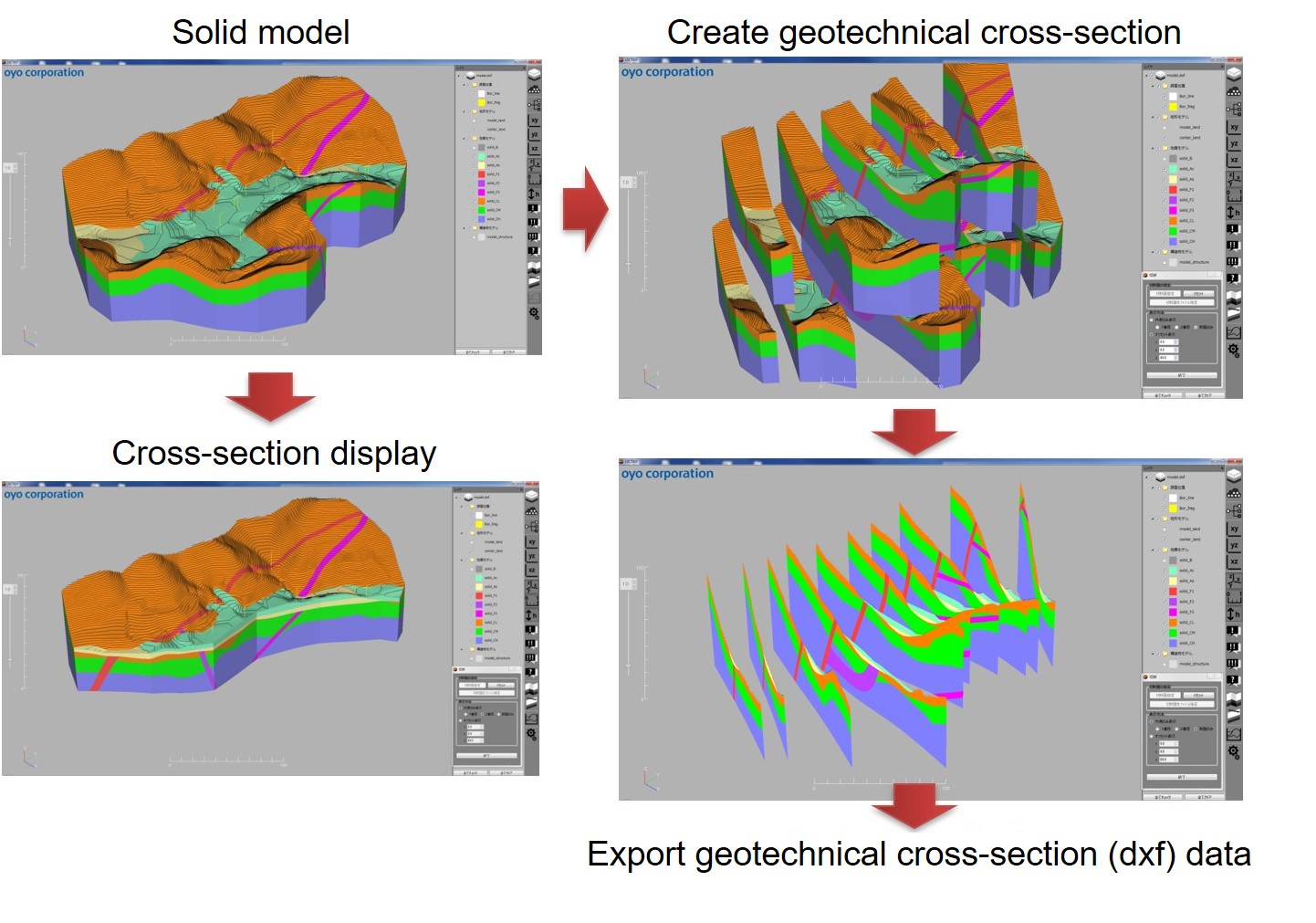
3. Export
- Display cross-sectional diagram
- Export cross-sectional diagram to CAD
System Requirements
| OS | Microsoft Windows 7/8.1/10 64bit recommended It can run in 32-bit OS, but performance will be reduced. |
|---|---|
| CPU | Intel Corei3~i7 or compable GPU |
| RAM | 8GB or more |
| GPU | OpenGL 2.x capable GPU recommended |
| Monitors | 1920 x 1080 (Full HD) or more |
| HDD/SSD Free spaces needed | For install: 100MB or more For work: 10GB or more |